


Outdoor Südtirol
Outdoor Südtirol का विवरण
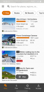
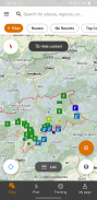
आस-पास की गतिविधियों को खोजने के लिए स्थान के आधार पर खोजें या अपना स्थान सक्रिय करें। अपनी रुचियों के आधार पर परिणामों को फ़िल्टर करें और नए खोजने के लिए मानचित्र का अन्वेषण करें। संक्षिप्त विवरण तुरंत देखने के लिए परिणामों को सूची के रूप में रखें।
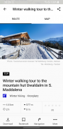
आप विस्तृत विवरण, तकनीकी जानकारी, नक्शे और जीपीएस दिशा-निर्देश प्राप्त कर सकते हैं जिन्हें आप दक्षिण टायरॉल में अपनी गर्मी और सर्दियों की बाहरी गतिविधियों के लिए ऑफ़लाइन भी सहेज सकते हैं।
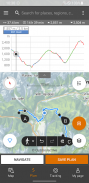
आप कस्टम यात्रा कार्यक्रम भी बना सकते हैं:
- ऐप के मानचित्र पर सीधे अपने यात्रा कार्यक्रम की योजना बनाएं
- अपना मार्ग रिकॉर्ड करें और फ़ोटो और विवरण जोड़ें
- दक्षिण टायरॉल और डोलोमाइट्स में अपने अगले बाहरी साहसिक कार्य की योजना बनाने के लिए अपने दोस्तों के साथ अपने पसंदीदा यात्रा कार्यक्रम साझा करें
और भी अधिक सुविधाओं की खोज करें!
जरूरी:
अपने जीपीएस सक्रिय होने के साथ पृष्ठभूमि में ऐप का उपयोग करने से बैटरी जीवन में काफी कमी आ सकती है।
Outdoor Südtirol - Version 3.17.8
(10-09-2024)Outdoor Südtirol - एपीके जानकारी
एपीके संस्करण: 3.17.8पैकेज: it.bz.smgLatest Version of Outdoor Südtirol
अन्य संस्करण


 3.55
3.55 4.34
4.34


Apps in the same category

You may also like...


